

J04D
Umpqua National Forest, Toketee, OR, USA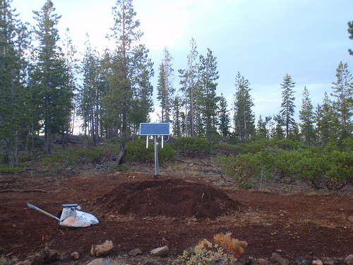
The USArray component of the NSF-funded EarthScope project ended its observational period in September 2021 and all remaining close-out tasks concluded in March 2022. Hundreds of seismic stations were transferred to other operators and continue to collect scientific observations. This USArray.org website is now in an archival state and will no longer be updated. To learn more about this project and the science it continues to enable, please view publications here: http://usarray.org/researchers/pubs and citations of the Transportable Array network DOI 10.7914/SN/TA.
To further advance geophysics support for the geophysics community, UNAVCO and IRIS are merging. The merged organization will be called EarthScope Consortium. As our science becomes more convergent, there is benefit to examining how we can support research and education as a single organization to conduct and advance cutting-edge geophysics. See our Joining Forces website for more information. The site earthscope.org will soon host the new EarthScope Consortium website.

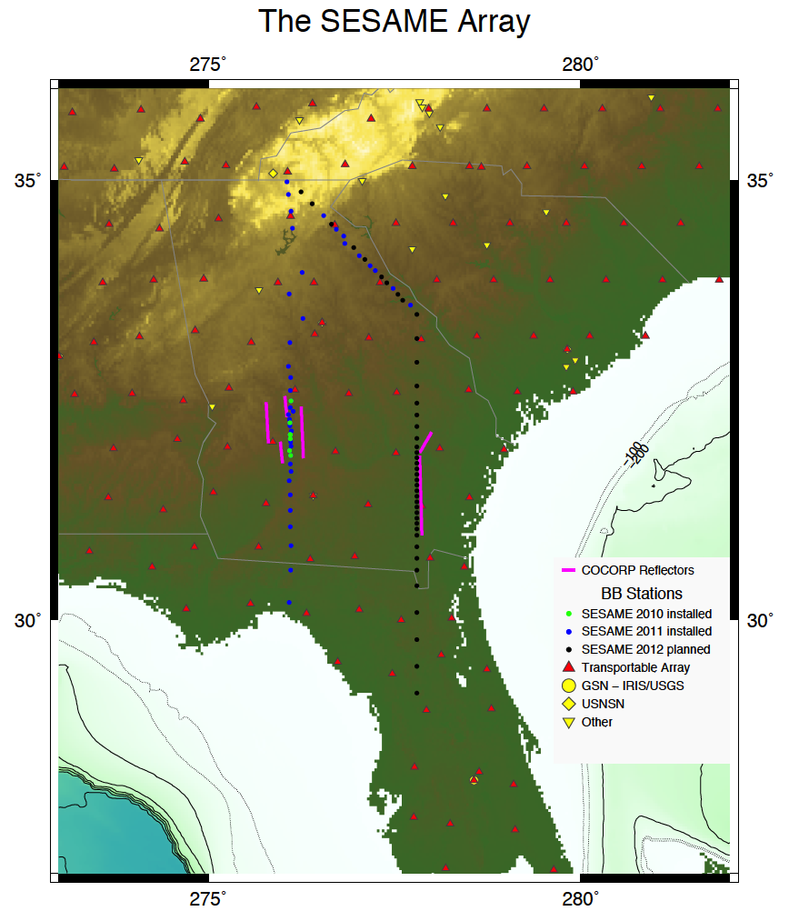 |
| Map of SESAME stations (as of November, 2011) and other broadband seismic stations in the region, superimposed on topography. Seven SESAME stations were deployed in July, 2010 (green dots), 35 in May, 2011 and two in October, 2011 (blue dots). The remaining installations are planned for May, 2012 (black dots). The stations are densest across the hypothesized location of the Gondwana-Laurentia suture in the crust, shown on the map by the locations of COCORP reflection line segments where southward-dipping reflectors were observed (e.g. McBride and Nelson, GSAB, 1988) (magenta lines). Two 2012 stations now shown in the western line that coincide with Transportable Array sites will likely be moved into the mountains to the NW of the current northern corner of the array. Three existing SESAME stations (W02, W14 and D05) are open access, and additional open stations will be designated among future sites. |
Principal Investigators and Institutions:
Karen Fischer, Brown University
Rob Hawman, University of Georgia
Lara Wagner, University of North Carolina- Chapel Hill
Don Forsyth, Brown University
Funding Source:
NSF EarthScope under the American Recovery and Reinvestment Act of 2009 (Public Law 111-5)
Field Dates:
7/2010 – 6/2014
Equipment Used:
85 Broadband stations
using Guralp CMG3T sensor and Reftek130 Datalogger
Data Status:
Archived 1 and 2 service
Network Code:
Z9
Description:
At the culmination of the lithospheric accretion that built the Appalachian Mountains (roughly 300 million years ago) the lithosphere of the super-continent Gondwana collided with proto-North America. The suture between these two continental lithospheres is thought to lie in the crust beneath southern Georgia based on variations in fossils, rock types and ages, and a zone of southward dipping reflectors imaged by seismic reflection data. However, the location and geometry of the suture in the mantle is unknown. This region subsequently experienced rifting associated with the initial opening of the Atlantic ocean. Offshore seismic studies have shown that large volumes of magma were added to the crust during rifting, but fundamental questions remain about how the mantle lithosphere was altered by extension and magmatic processes.
The goal of SESAME (the Southeastern Suture of the Appalachian Margin Experiment) is to better understand how the continental lithosphere was accreted and deformed during continental collision and how the lithosphere was later modified by rifting and the development of the Atlantic passive margin. 85 EarthScope USArray Flexible Array broadband stations are being deployed in two N-S arrays that cross the suture; both lines have their densest station spacing directly over the location of the suture in the crust. A third leg is oriented roughly normal to Appalachian crustal terranes in northern Georgia. These stations, together with the stations of the EarthScope USArray Transportable Array, are recording seismic waves from around the globe. These data are being analyzed to measure three-dimensional variations in isotropic and anisotropic wave velocities, and the velocity models will be interpreted in terms of temperature, rock composition (including volatile content), and rock deformation fabrics.
These results should help to constrain models for how continental lithosphere deforms during continental collision and how it is altered by later continental rifting. Questions of particular interest include: How does the crustal suture connect to mantle structures? What was the direction of subduction associated with the collision of Gondwana and Laurentia? Did mantle accretion occur on shallow dipping shear zones or through horizontal shortening over a broad depth range? Or was the suture a largely strike-slip boundary? Do the bulk properties (composition, fabric, etc.) of the two lithospheres differ? How was the continental lithosphere altered by Mesozoic extension, rifting and magmatism, and what role did the suture play? Is there evidence for delamination of the lithosphere? What are the present-day patterns of flow in the underlying mantle asthenosphere?
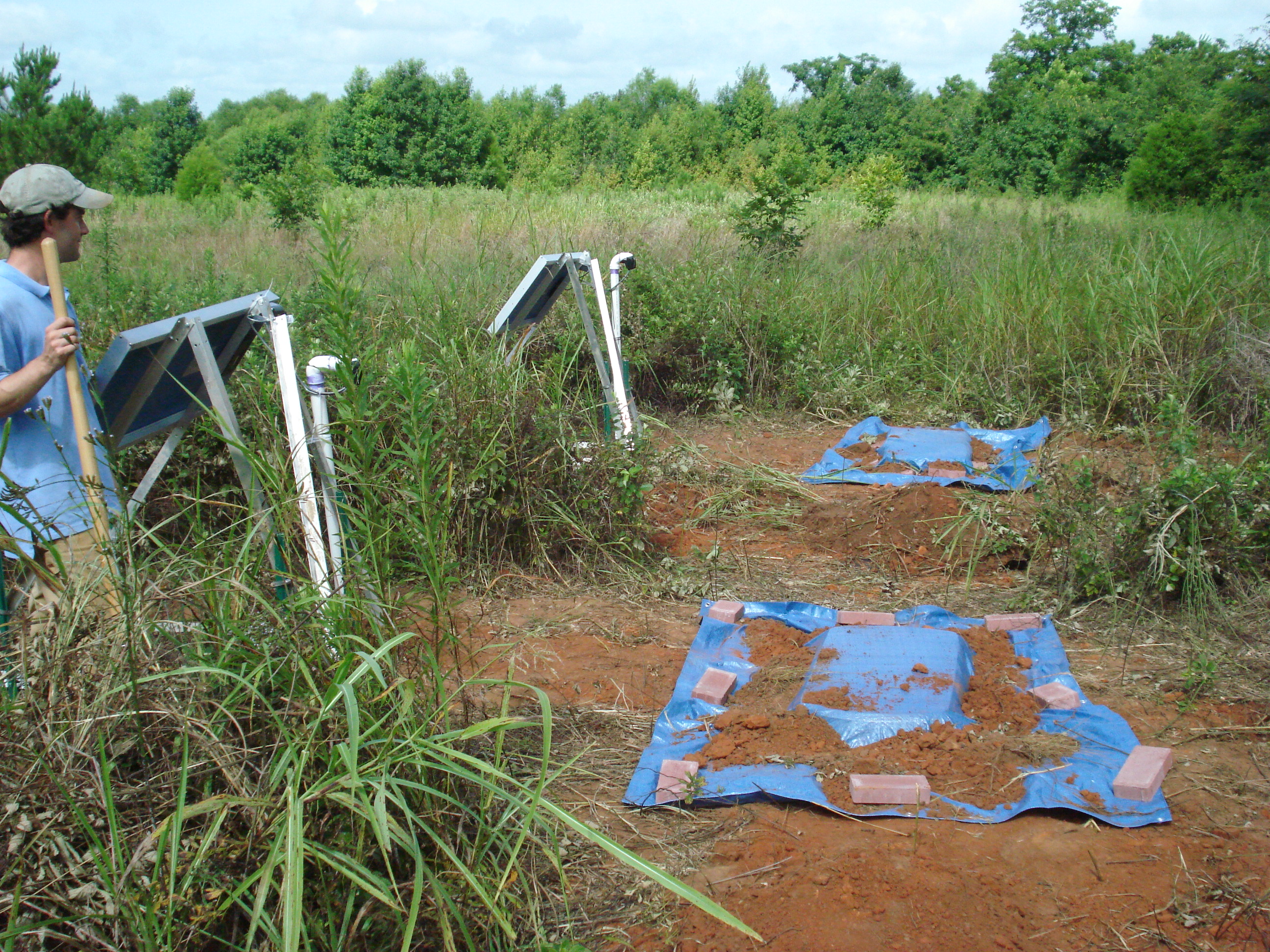 |
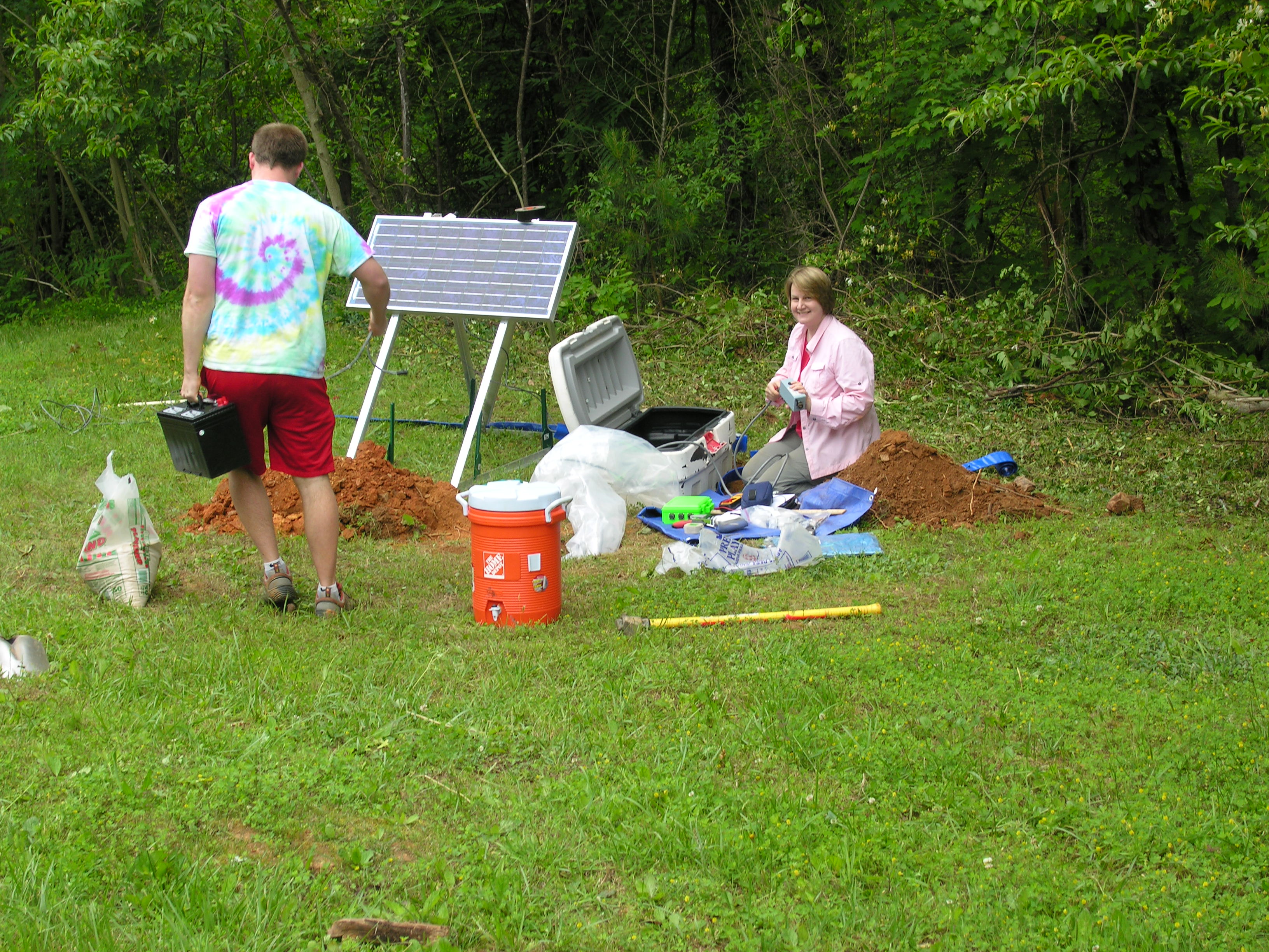
| University of Georgia grad student Horry Parker at stations W15A and W15B. Data collected from our initial installation of 7 broadband stations in July, 2010 were used as the basis for our decision to employ direct burial for stations deployed in May, 2011 and later. We compared data from a Guralp CMG-3T sensor installed using direct burial (station W15B, in foreground) and another installed in a typical Flexible Array vault (W15A) at a single site on the western N-S transect. |
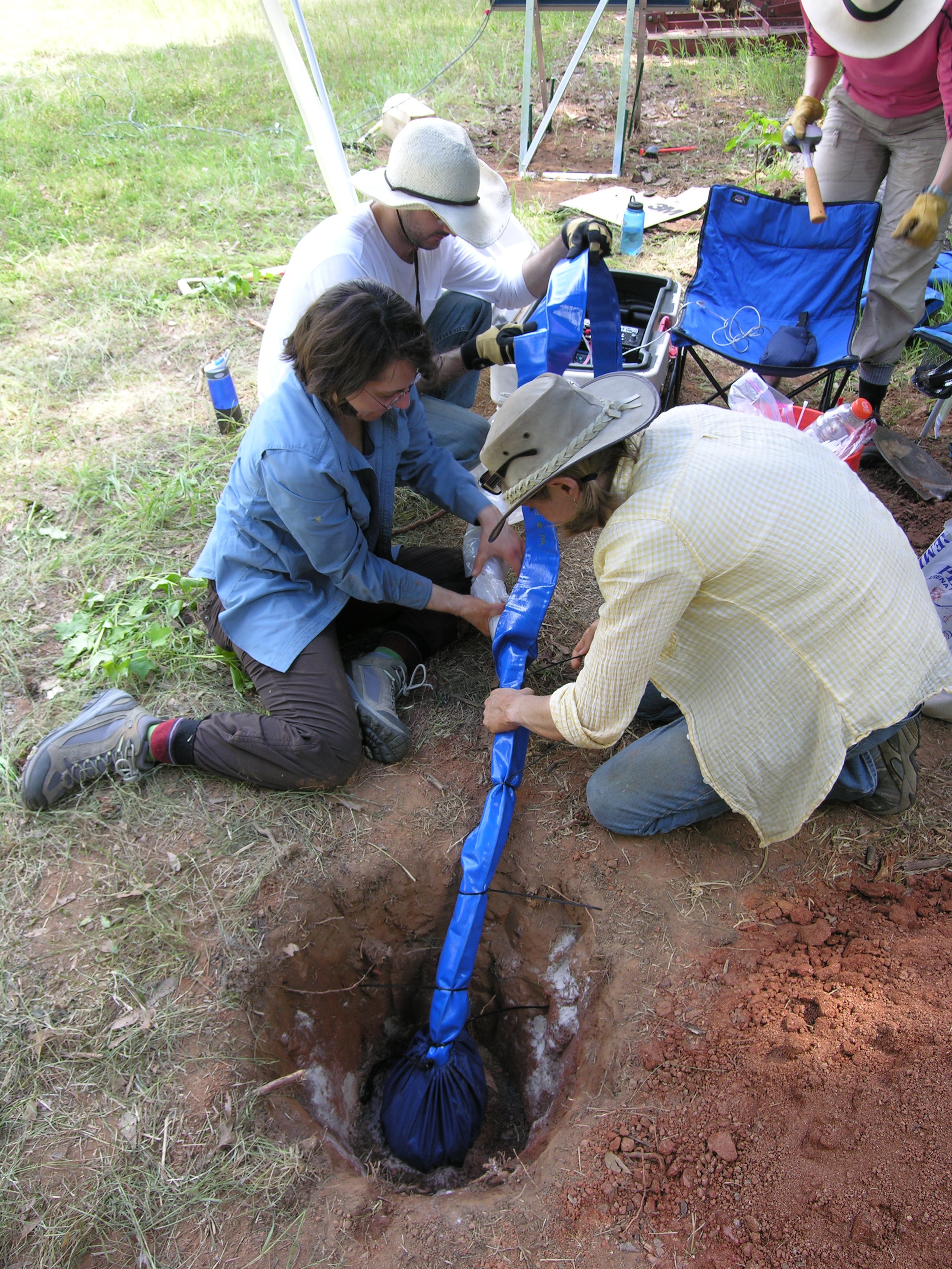 |
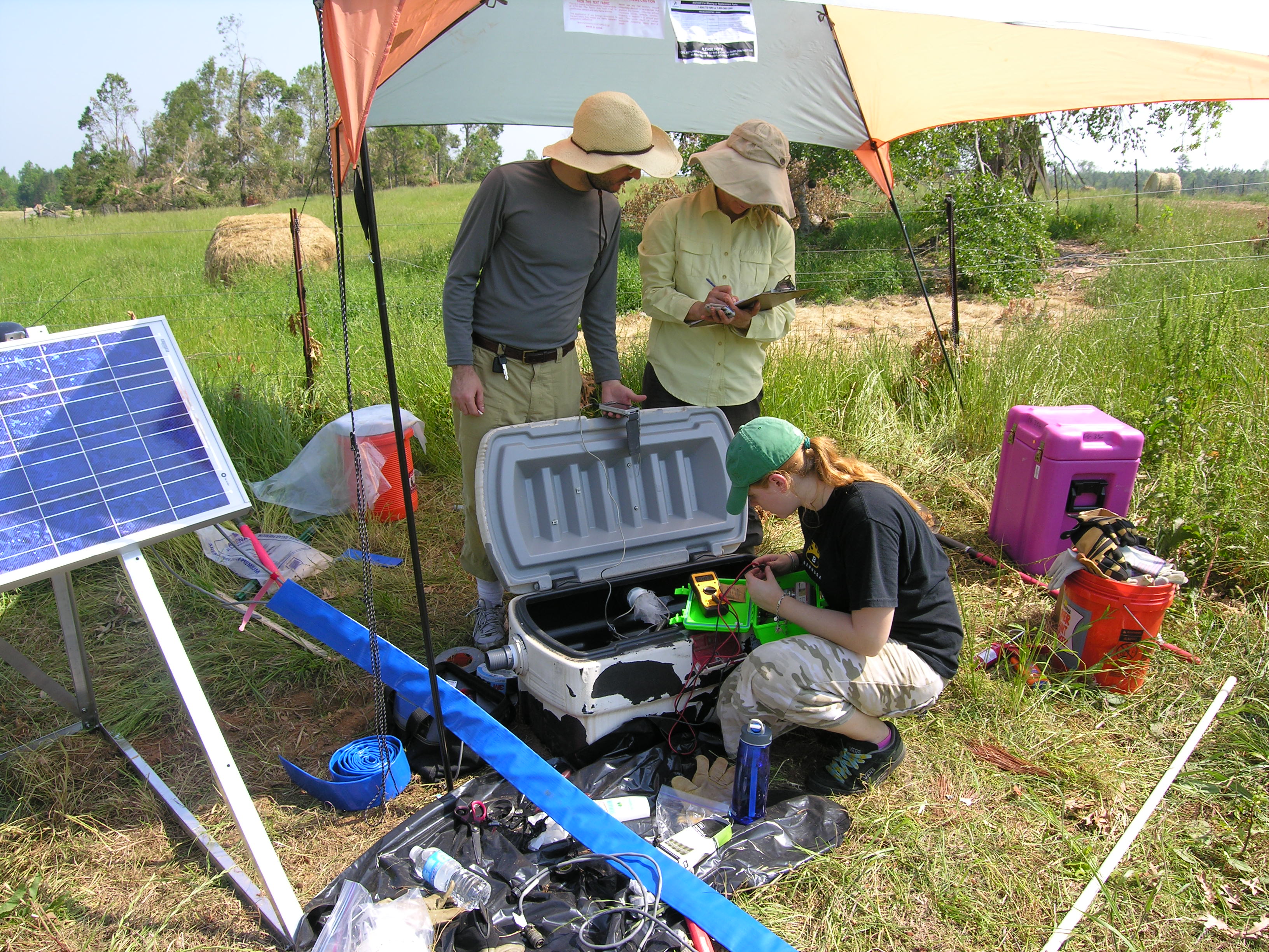
| Direct burial installation of the sensor at W30 in May, 2011. Left to right: Pnina Miller (PIC), Ved Lekic (Brown University, now at University of Maryland), and Lara Wagner and Sara Hanson-Hedgecock (University of North Carolina, Chapel Hill). |
 |
| Installing station W28 in May, 2011. Left to right: Ved Lekic (Brown University, now at University of Maryland), Pnina Miller (PIC), and Julia MacDougall (Brown University). |
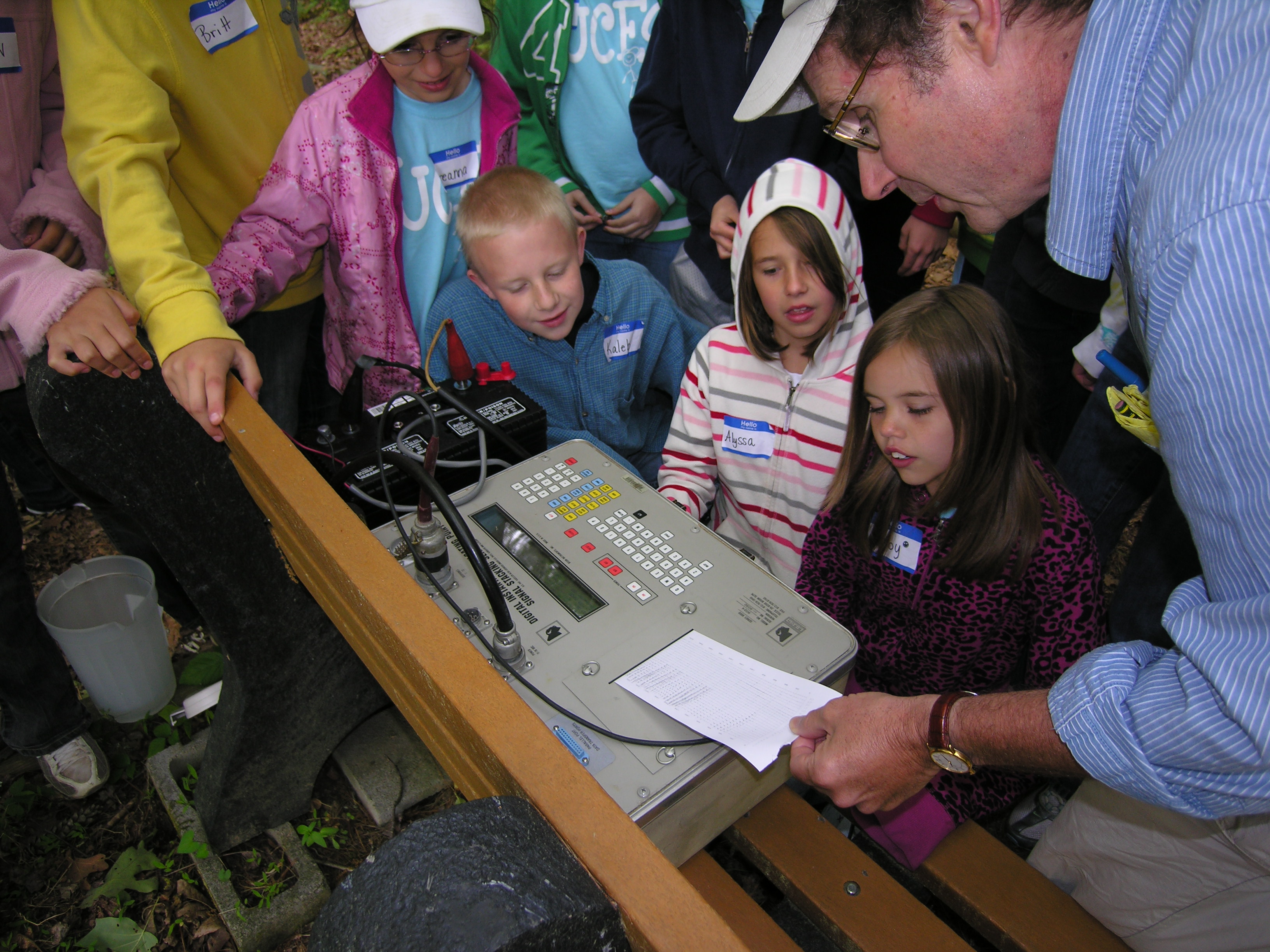 |
| Rob Hawman (University of Georgia) (right) explaining seismograms to schoolchildren during a May, 2011 “science field day” at the Georgia Mountain Research and Education Center in the Blue Ridge Mountains near Blairsville, GA (the site of station W34). The seismograms show geophone recordings of an “earthquake” created by the kids jumping. In 2011, Rob has worked with over 450 children in rural counties of Georgia. |
 |
| Installing station W34 at the Georgia Mountain Research and Education Center in May, 2011. Davison Hogan (University of Georgia) (left) and Karen Fischer (Brown University). |
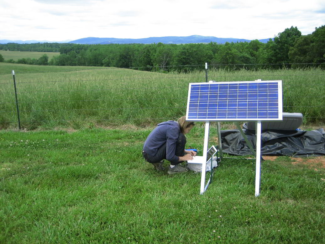 |
| Lara Wagner (University of North Carolina, Chapel Hill) checking data at station D17. |

