

W18A
Petrified Forest, AZ, USA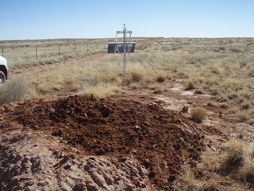
The USArray component of the NSF-funded EarthScope project ended its observational period in September 2021 and all remaining close-out tasks concluded in March 2022. Hundreds of seismic stations were transferred to other operators and continue to collect scientific observations. This USArray.org website is now in an archival state and will no longer be updated. To learn more about this project and the science it continues to enable, please view publications here: http://usarray.org/researchers/pubs and citations of the Transportable Array network DOI 10.7914/SN/TA.
To further advance geophysics support for the geophysics community, UNAVCO and IRIS are merging. The merged organization will be called EarthScope Consortium. As our science becomes more convergent, there is benefit to examining how we can support research and education as a single organization to conduct and advance cutting-edge geophysics. See our Joining Forces website for more information. The site earthscope.org will soon host the new EarthScope Consortium website.

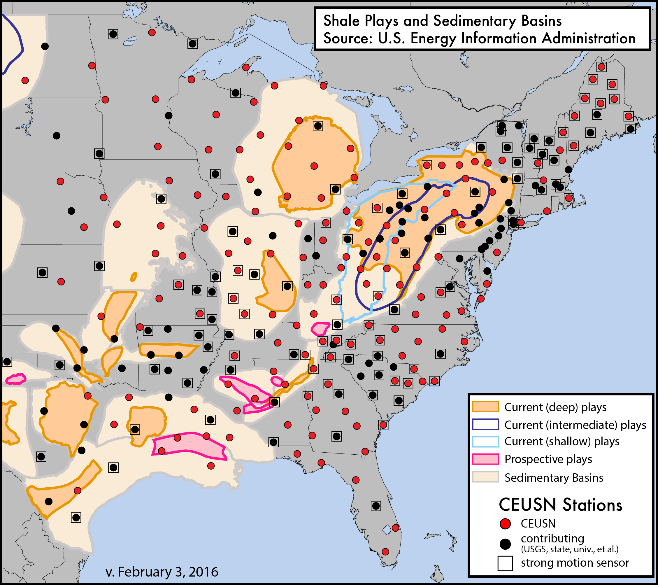
Several Federal agencies (the National Science Foundation, United States Geological Survey, United States Nuclear Regulatory Commission, and Department of Energy) recognized the unique opportunity to retain Transportable Array seismic stations in the Central and Eastern United States (CEUS) beyond the standard deployment of two years per site. The IRIS-operated long-term sub-array, known as the CEUSN, incorporates multiple criteria for site selection that were weighed by an inter-agency TA Station Selection (TASS) Working Group. In general, the stations were chosen in order to maintain a close to uniform distribution while focusing on specific criteria including proximity to known regions of seismic hazard, nuclear power plants and other critical facilities, and potential scientific targets. The site selection also deemphasized regions with significant numbers of existing permanent seismic networks. The TASS report "TA Station Selection Strategy and Recommendations" is available to review.
Recent earthquakes in the CEUS, including the 2011 M5.8 Virginia earthquake, have raised awareness of the comparative lack of knowledge about seismicity, site response to ground shaking, and the basic geologic underpinnings in this densely populated region of the country. The mission of the CEUSN was to produce data that enabled researchers and Federal agencies alike to better understand the basic geologic questions, background rates of earthquake occurrence and distribution, seismic hazard potential, and associated societal risks of this region. This example of multi-agency collaboration demonstrated a key example of "good government" that is motivated by the opportunity to use one facility to address multiple missions and needs in a way that is rarely available.
Broadband and strong motion sensors at CEUSN stations record at 100 samples per second (sps). In 2014, IRIS produced high sample rate data (200 sps) on a trial basis with network detected event triggering. In August 2015, a Working Group for the CEUSN was formed, and charged to review and provide advice to IRIS Management and the Instrumentation Services Standing Committee on the performance of the CEUSN as it relates to the target scientific goals and objectives. The working group provided guidance on the CEUSN both specifically, and in the broader context of the ANSS stations operating in the CEUS. The composition of the WG was intentionally very broad, with the goal of obtaining feedback from all relevant CEUSN stakeholders, including academic, federal and state governments, and relevant policy stakeholders. The Transportable Array Manager and the Director of Instrumentation Services were the primary IRIS staff liaisons with the Working Group (WG), and coordinated with the CEUSN WG Chair to develop topics and questions for review and action by the CEUSN WG.
IRIS operated the 159 CEUSN N4 stations through September 30, 2018, before transitioning operations to USGS. The CEUSN WG has since been disbanded.
View a summary report of the CEUSN, Taking Root: The IRIS-Operated Stations of the Central and Eastern US Network.
Find out more about the CEUSN Working Group here.
CEUSN and Associated Networks Google Earth Layers (.zip of kmz files)
CEUSN TA/N4 Station Coordinates and Status (.kml file)
_CEUSN Virtual Network Listing
High Resolution CEUSN Brochure
IRIS Special Event Page for 2/14/14 M4.1 Edgefield, SC Earthquake

