

TOLK
Toolik Lake Research Station, AK, USA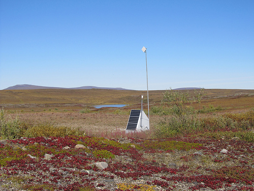
The USArray component of the NSF-funded EarthScope project ended its observational period in September 2021 and all remaining close-out tasks concluded in March 2022. Hundreds of seismic stations were transferred to other operators and continue to collect scientific observations. This USArray.org website is now in an archival state and will no longer be updated. To learn more about this project and the science it continues to enable, please view publications here: http://usarray.org/researchers/pubs and citations of the Transportable Array network DOI 10.7914/SN/TA.
To further advance geophysics support for the geophysics community, UNAVCO and IRIS are merging. The merged organization will be called EarthScope Consortium. As our science becomes more convergent, there is benefit to examining how we can support research and education as a single organization to conduct and advance cutting-edge geophysics. See our Joining Forces website for more information. The site earthscope.org will soon host the new EarthScope Consortium website.

USArray seismic data will further our understanding of the earth and of tectonic processes. This has also led to cutting edge scientific research. There are also many practical applications for these data (see below).
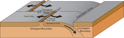
The North American continent displays the full spectrum of plate tectonic processes, making it a great place to study both active and ancient structures:
The plate boundary of western North America—the San Andreas Fault system, the Cascadia and Aleutian subduction zones, and the Intermountain seismic belt—includes significant regions of earthquake, volcanic, and landslide hazards. All EarthScope components provide data that bear directly on the assessment and mitigation of the risks from these hazards. These data are advancing our knowledge of the mechanics of volcanic eruption and earthquake generation, and increase the possibility of earthquake prediction. As the Transportable Array crosses the nation, EarthScope scientists are interacting with federal and state agencies involved in regional mapping, education, public policy, and resource assessment. The Flexible Array component of USArray is an important tool for probing the geological framework of the continental crust and the structural details of sedimentary basins. Subsurface maps, developed from various types of geological investigations and merged with high-resolution seismic images, are an invaluable resource in collaborative and multidisciplinary research projects related to the assessment and exploitation of groundwater, mineral, and energy resources.
Seismology is a relatively new science. Geologic mapping of the past 150 years, combined with seismic advances in the 1900s, provided framework for looking beneath Earth's surface. Because of technical constraints, 20 years ago USArray was a dream. It is now a reality because we have three necessary components:

