

BGNE
Belgrade, NE, USA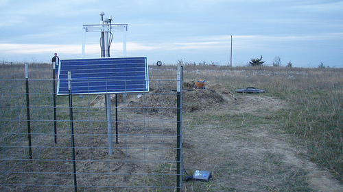
The USArray component of the NSF-funded EarthScope project ended its observational period in September 2021 and all remaining close-out tasks concluded in March 2022. Hundreds of seismic stations were transferred to other operators and continue to collect scientific observations. This USArray.org website is now in an archival state and will no longer be updated. To learn more about this project and the science it continues to enable, please view publications here: http://usarray.org/researchers/pubs and citations of the Transportable Array network DOI 10.7914/SN/TA.
To further advance geophysics support for the geophysics community, UNAVCO and IRIS are merging. The merged organization will be called EarthScope Consortium. As our science becomes more convergent, there is benefit to examining how we can support research and education as a single organization to conduct and advance cutting-edge geophysics. See our Joining Forces website for more information. The site earthscope.org will soon host the new EarthScope Consortium website.

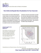
Flyer for Earthquake Wave Visualizations (0.4 MB)
Link to Earthquake Wave Visualizations
Animations of real data showing how seismic waves sweep the array of seismometers.
For more earth science publications, activities, professional development, internships, animations, museum displays, free software and more, visit EarthScope Education and Outreach and IRIS Education and Outreach.

