

KSCO
Kaye Shedlock's, Cheyenne Wells, CO, USA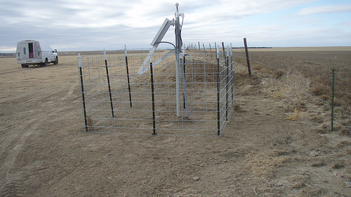
The USArray component of the NSF-funded EarthScope project ended its observational period in September 2021 and all remaining close-out tasks concluded in March 2022. Hundreds of seismic stations were transferred to other operators and continue to collect scientific observations. This USArray.org website is now in an archival state and will no longer be updated. To learn more about this project and the science it continues to enable, please view publications here: http://usarray.org/researchers/pubs and citations of the Transportable Array network DOI 10.7914/SN/TA.
To further advance geophysics support for the geophysics community, UNAVCO and IRIS are merging. The merged organization will be called EarthScope Consortium. As our science becomes more convergent, there is benefit to examining how we can support research and education as a single organization to conduct and advance cutting-edge geophysics. See our Joining Forces website for more information. The site earthscope.org will soon host the new EarthScope Consortium website.

Principal Investigators and Institutions:
Steven Roecker, Rensselaer Polytechnic Institute
Clifford Thurber, University of Wisconsin- Madison
Funding Source:
NSF EarthScope
Field Dates:
10/2004 – 10/2006
Equipment Used:
12 RefTeks
Data Status:
Fully Archived
Network Code:
YH
Description:
A key objective of the San Andreas Fault Observatory at Depth (SAFOD) project is to drill through the rupture patch of a small repeating earthquake. The size of the rupture patch is on the order of tens of meters; hence knowing its location to a comparable degree of accuracy is vital to SAFOD's success. Results from previous work in this area by PI's Thurber and Roecker, which involved the analysis of data from the deployment of dense, temporary networks of seismic stations (PASO-UNO and PASO-DOS) in the vicinity of the drill site, show that while the epicenter of the target patch is consistent with the results of a previous study, the depth is significantly shallower than anyone previously supposed; different enough to require rethinking the original drilling plan. Results from a number of trial inversions, including the application of two different tomographic techniques, indicate that this result is robust. The uncertainty in depth estimated to be on the order of 200-m, which, while an improvement over previous efforts, is still larger than what would be required to successfully guide the three phases of SAFOD drilling (Phases I and II require ~100-m accuracy, while Phase III requires ~10-m accuracy). This project is applying recently developed and upgraded analysis techniques to both increase the amount of data currently available and significantly reduce the level of noise. A new double-difference tomography technique is also being utilized that has been shown to dramatically improve both event locations and wavespeed images over those obtained with standard techniques. In addition, important new data is now available from a set of November 2003 seismic experiments. This is a critical new dataset, and its analysis and incorporation into the modeling will lead to significant improvements to the model and earthquake locations. These steps are expected to yield a reduction in uncertainties to less than 100-m by the time Phase I drilling begins in summer 2004. Once Phase I drilling is complete, a temporary seismic network (PASO-TRES) will installed and operated for 12 months, reoccupying 12 of the PASO-DOS sites. In addition to recording ambient seismicity simultaneously with the instruments in the drill hole and permanent stations in the area, signals from 10 small (~2 lb) shots will be recorded in order to calibrate wavespeeds and estimate absolute location accuracy by treating the downhole sensors as "virtual earthquakes." The combination of PASO-TRES data, both active and passive, with those from the permanent stations near the drill site (HRSN and USGS) and downhole sensors, when subjected to the same analysis techniques as those employed on PASO-DOS, will allow a further reduction in the uncertainties in hypocenter location to the level required to direct the Phase II drilling.
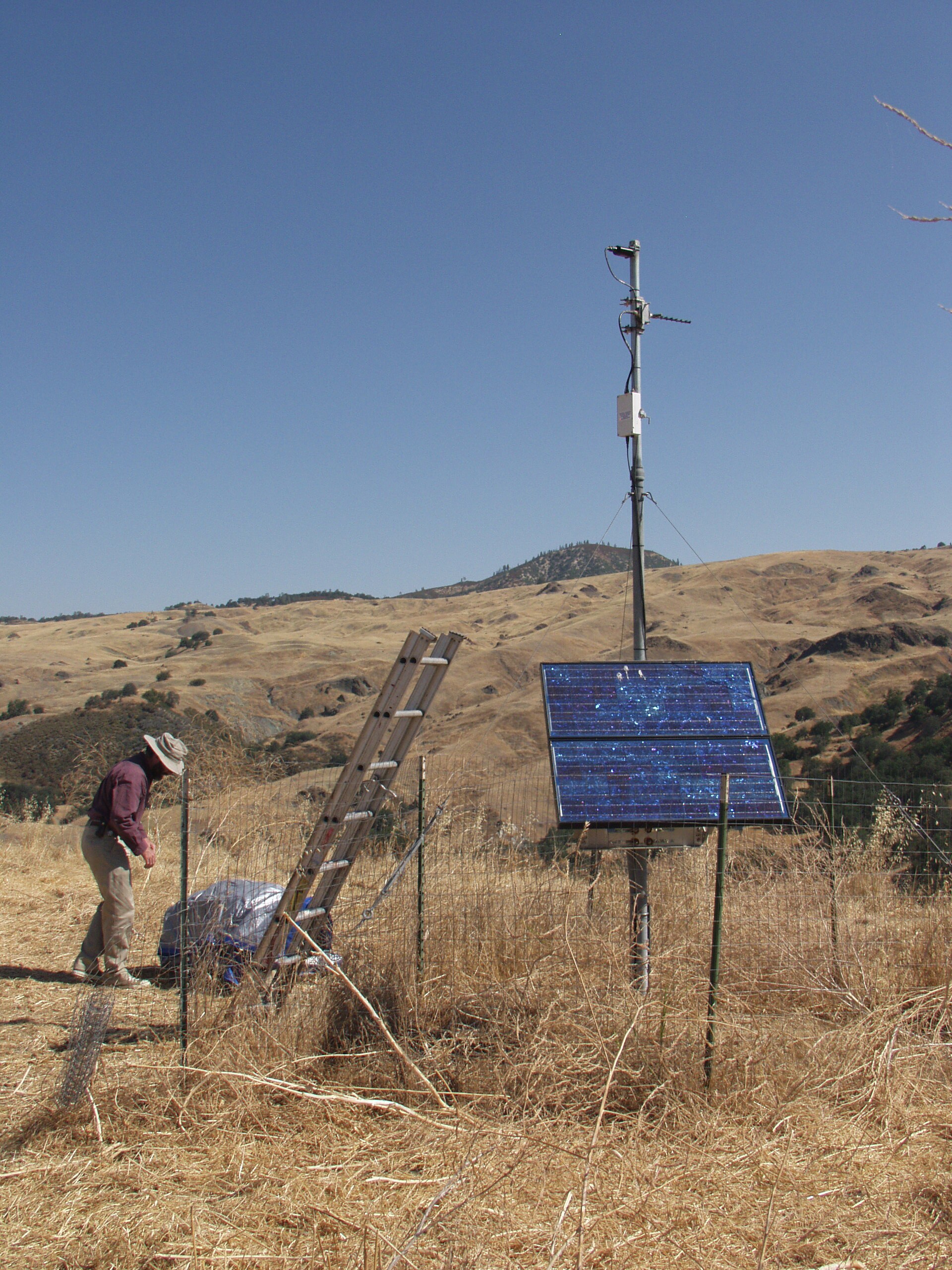
A completed PASO-TRES site

