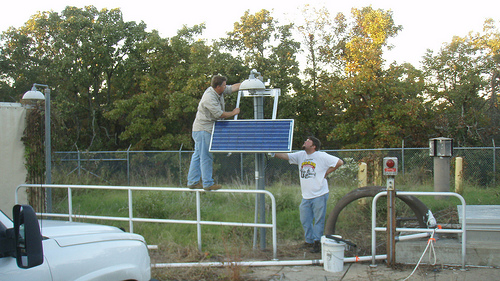
TUL1
Leonard, OK, USA
The USArray component of the NSF-funded EarthScope project ended its observational period in September 2021 and all remaining close-out tasks concluded in March 2022. Hundreds of seismic stations were transferred to other operators and continue to collect scientific observations. This USArray.org website is now in an archival state and will no longer be updated. To learn more about this project and the science it continues to enable, please view publications here: http://usarray.org/researchers/pubs and citations of the Transportable Array network DOI 10.7914/SN/TA.
To further advance geophysics support for the geophysics community, UNAVCO and IRIS are merging. The merged organization will be called EarthScope Consortium. As our science becomes more convergent, there is benefit to examining how we can support research and education as a single organization to conduct and advance cutting-edge geophysics. See our Joining Forces website for more information. The site earthscope.org will soon host the new EarthScope Consortium website.


Raymond Russo, (P.I. Passive Broadband study) University of Florida
John Hole, (P.I. Active source study) Virginia Polytechnic Institute
Funding Source:
NSF EarthScope
Field Dates:
Passive Experiment: 5/2011 – 5/2013
Active Experiment 7/2012 - 9/2012
Equipment Used:
Passive Experiment: Gurlap CMG3T/Raftek130 Datalogger
Active Experiment: TEXANS
Data Status:
Passive Experiment: Archived 1 Service
Network Code:
Passive Expoeriment: XT
Description:
Much of the land area of Washington, Oregon, and California was added to continental North America during the last 200 million years. Exactly how this dominantly oceanic lithosphere accreted to the continent is not well understood, although it is clear that the processes involved differed from north to south along North America's former western margin. In the Idaho-Oregon border region, the boundary between oceanic and continental lithospheres is well exposed in a very narrow zone of high deformation known as the western Idaho shear zone. This project is providing insight into how this sharp boundary formed, how it has controlled subsequent deformation and magmatism regionally, and the role it has played in the formation of North America. Because the Oregon-Idaho segment separates distinct styles of mountain building in California and the southern Canadian Cordillera, a better understanding of this complex region is critical for developing a coherent model for the tectonic evolution of western North America and ultimately helping us understand proceses by which continents are created and evolve through time.
Research scientists from the University of Wisconsin, Virginia Tech, The University of Florida, and Washington State University are integrating the results of seismological, geochemical, geochronologic, and structural geologic studies in order to investigate three major issues associated with the evolution of this continental margin: 1) How do fundamental lithospheric structures, such as the continental-oceanic lithosphere boundary exposed in the western Idaho shear zone, guide subsequent deformation and magmatism?; 2) How do magmatism and extensional deformation modify (destabilize) the continental lithosphere, and at what lithospheric levels?; and 3) What are the tectonic implications of this destabilization for evolving magmatism, deformation, and lithospheric strength? A swath of broadband passive seismic instruments and a seismic refraction line will delineate the current geometry of the major geologic units and their boundaries to several hundred kilometers depth. Geochemistry and geochronology will characterize post- western Idaho shear zone magmatism to provide the timing of events and the tectonic context in which these processes occurred. Structural geology will provide the kinematic and dynamic deformation path by which the continent was modified, by defining the major tectonic boundaries and establishing the kinematic history of the major structures.