

J01E
Myrtle Point, OR, USA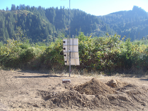
The USArray component of the NSF-funded EarthScope project ended its observational period in September 2021 and all remaining close-out tasks concluded in March 2022. Hundreds of seismic stations were transferred to other operators and continue to collect scientific observations. This USArray.org website is now in an archival state and will no longer be updated. To learn more about this project and the science it continues to enable, please view publications here: http://usarray.org/researchers/pubs and citations of the Transportable Array network DOI 10.7914/SN/TA.
To further advance geophysics support for the geophysics community, UNAVCO and IRIS are merging. The merged organization will be called EarthScope Consortium. As our science becomes more convergent, there is benefit to examining how we can support research and education as a single organization to conduct and advance cutting-edge geophysics. See our Joining Forces website for more information. The site earthscope.org will soon host the new EarthScope Consortium website.

Principal Investigators and Institutions:
Maureen Long, Yale University
Eric Kirby, Oregon State University
Scott King, Virginia Tech
Funding Source:
NSF EarthScope
Field Dates:
6/2013 – 8/2016 (tentative)
Equipment Used:
28 broadband sensors
Data Status:
91 GB archived
Network Code:
7A
Description:
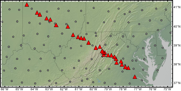
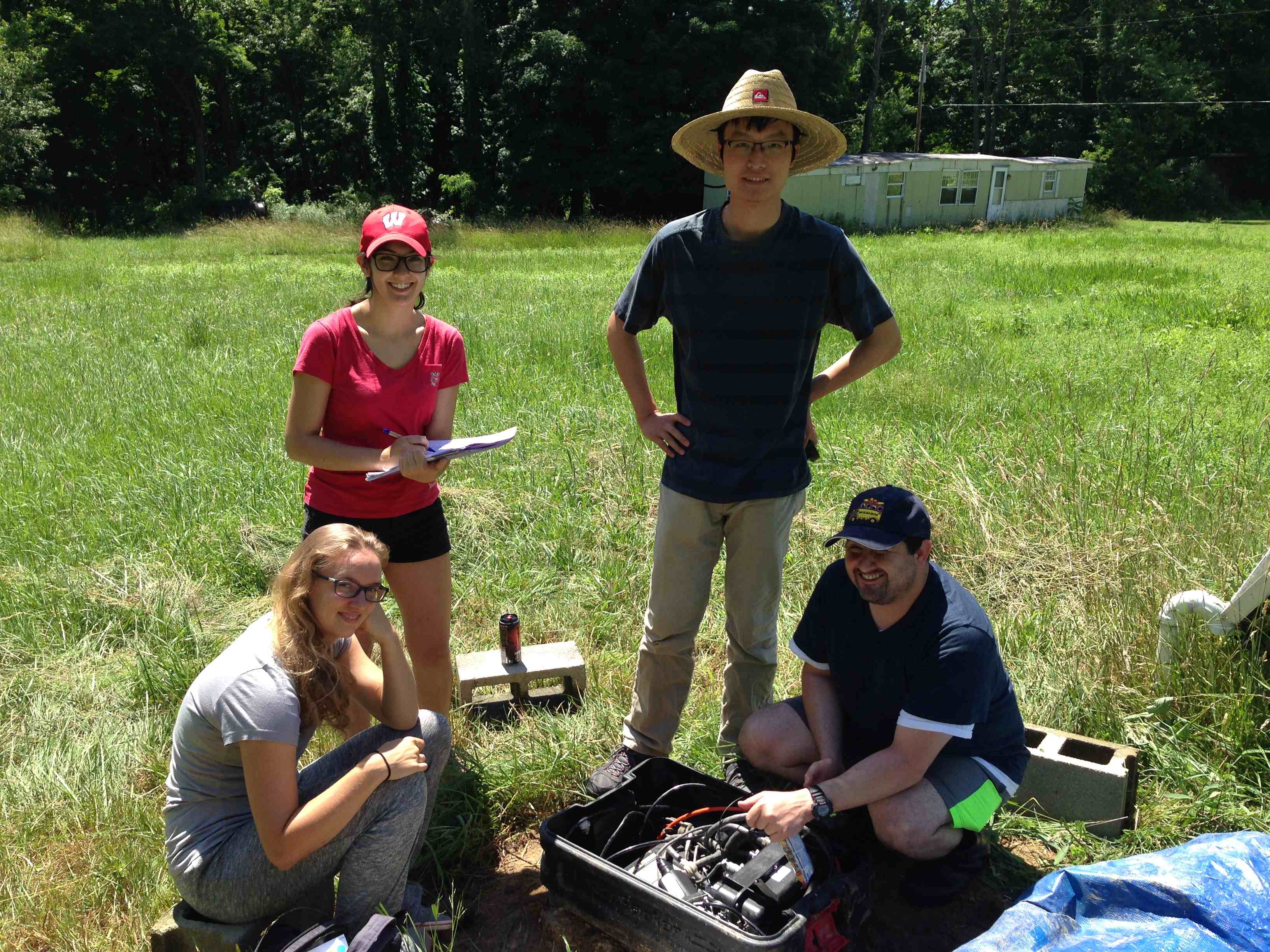
The surface geology of the eastern United States is extraordinary in its complexity. This complexity reflects a wide range of tectonic processes that have operated in the region over the past billion years, including episodes of subduction and rifting associated with two complete cycles of supercontinent assembly and breakup. A record of these processes is preserved in the geological units and topography we see at the surface today. It is unknown, however, how the crust and mantle lithosphere have responded to these tectonic forces over time, and whether and how the geological units preserved at the surface relate to deeper structures. The persistence of Appalachian topography through time remains a major outstanding problem in the study of landscape evolution. There is an ongoing interplay among erosion, topography, rock type, and mantle flow at depth that controls the structures we see at the surface today. However, understanding the complex role played by each of these factors requires better constraints on the history of topographic change and its relationship to the deep structure and dynamics of the mantle. Our project, known as the Mid-Atlantic Geophysical Integrative Collaboration (MAGIC), aims to address these fundamental questions about the geophysical evolution of the eastern United States by studying surface processes, crustal and lithospheric structure, and deep mantle flow across Virginia, West Virginia, and Ohio.
MAGIC involves a collaborative effort among seismologists, geodynamicists, and geomorphologists. We are undertaking a two-year deployment of 28 broadband seismometers in a dense linear transect from the Atlantic coast to the continental interior. In combination with EarthScope USArray Transportable Array (TA) stations our experiment geometry will provide an opportunity to image isotropic and anisotropic crust and mantle structure from the coast to the continental interior in unprecedented detail, using techniques such as shear wave splitting, receiver function analysis, and tomographic inversions. The dense linear array allows us to target small-scale crustal and lithospheric variations for imaging. Our geodynamical modeling effort focuses on quantitatively testing several different hypotheses for the pattern of mantle flow by using 3-D, time-dependent, numerical models to make testable predictions about mantle anisotropy and surface topographic change, which will be tested against results from the seismology and geomorphology components of the project. The geomorphology component of the project uses quantitative stream profile data and cosmogenic isotopes to understand the history of erosion rates and topographic change throughout the Appalachian region. Insights into uplift history and the approach to equilibrium among lithology, topography, and erosion (and their spatial variation) will be compared to inferences on the mantle flow field and deep crustal and lithospheric structure gained from the geodynamics and seismology components of the project. Insight from all three efforts will be combined to obtain a vertically integrated picture of tectonic processes from the surface through the crust and mantle lithosphere to the asthenosphere and deeper mantle. The education and outreach component of this project focuses on the involvement of undergraduates in scientific research, opportunities for graduate students to mentor and advise undergraduate students, and forging ties with colleges and universities (including many primarily undergraduate institutions) in our study region that are not currently involved with the EarthScope initiative.
Setting up the station enclosure
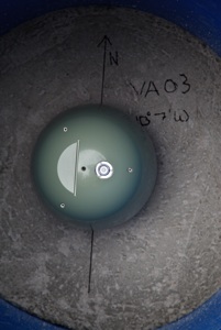
Orienting the seismometer in the vault
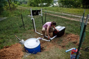
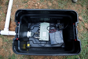
Putting the station together
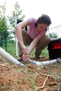
Applying a bit of elbow grease
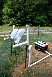
Completed station
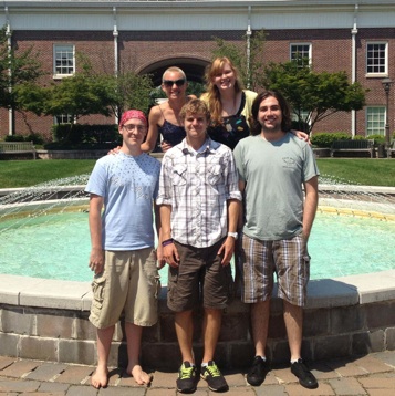
Some of the field crew
More field crew
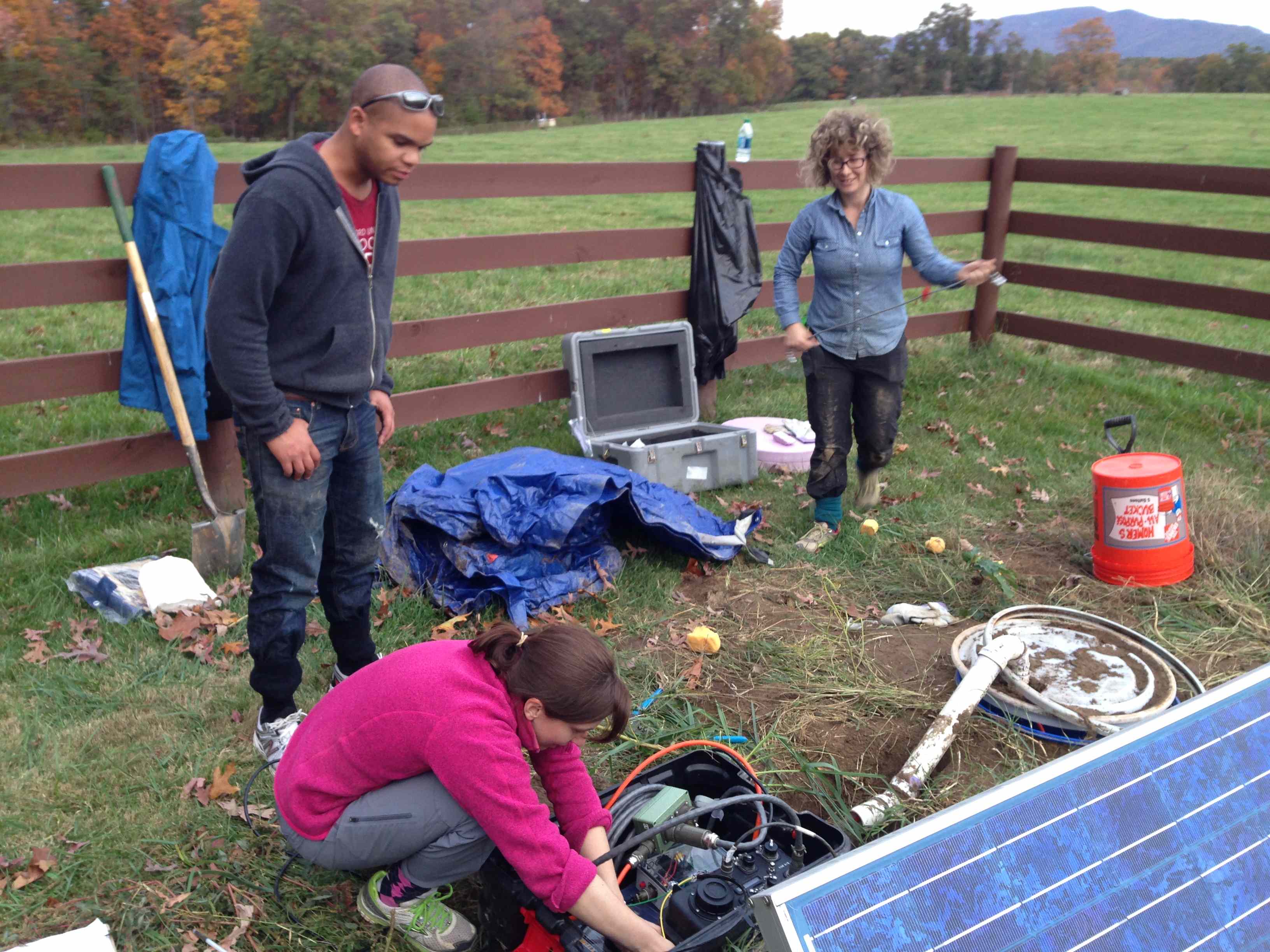
Installing a station

