

Z41A
Richland Creek Farm, El Dorado, AR, USA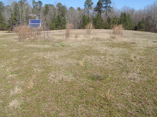
The USArray component of the NSF-funded EarthScope project ended its observational period in September 2021 and all remaining close-out tasks concluded in March 2022. Hundreds of seismic stations were transferred to other operators and continue to collect scientific observations. This USArray.org website is now in an archival state and will no longer be updated. To learn more about this project and the science it continues to enable, please view publications here: http://usarray.org/researchers/pubs and citations of the Transportable Array network DOI 10.7914/SN/TA.
To further advance geophysics support for the geophysics community, UNAVCO and IRIS are merging. The merged organization will be called EarthScope Consortium. As our science becomes more convergent, there is benefit to examining how we can support research and education as a single organization to conduct and advance cutting-edge geophysics. See our Joining Forces website for more information. The site earthscope.org will soon host the new EarthScope Consortium website.

Principal Investigators and Institutions:
William Menke, LDEO / Columbia University
Vadim Levin, Rutgers University
Fiona Darbyshire, UQAM
Alessandro Forte, UQAM
Andrew Hynes, McGill University
Funding Source:
NSF EarthScope
Field Dates:
8/2012 – 8/2016 (tentative)
Equipment Used:
3 broadband and 6 short-period sensors
Data Status:
318 GB archived
Network Code:
X8
Description:
Our world's continents have been compared to both icebergs and onions. They are like icebergs in that they consist of a buoyant solid floating on a sea of deeper denser material, and also in that they are mostly unseen, with keels extending down to 250 km (150 mi) beneath the Earth's surface. They are like onions in that they consist of a central core surrounded by a sequence of younger layers that has grown around it. The process by which continents were formed remains a geologic mystery. Two of the keys to that mystery lie in the structure of the deepest part of the central core (or "craton", to use the geologic term) and of the boundaries between the layers ("sutures" or "terrain boundaries").
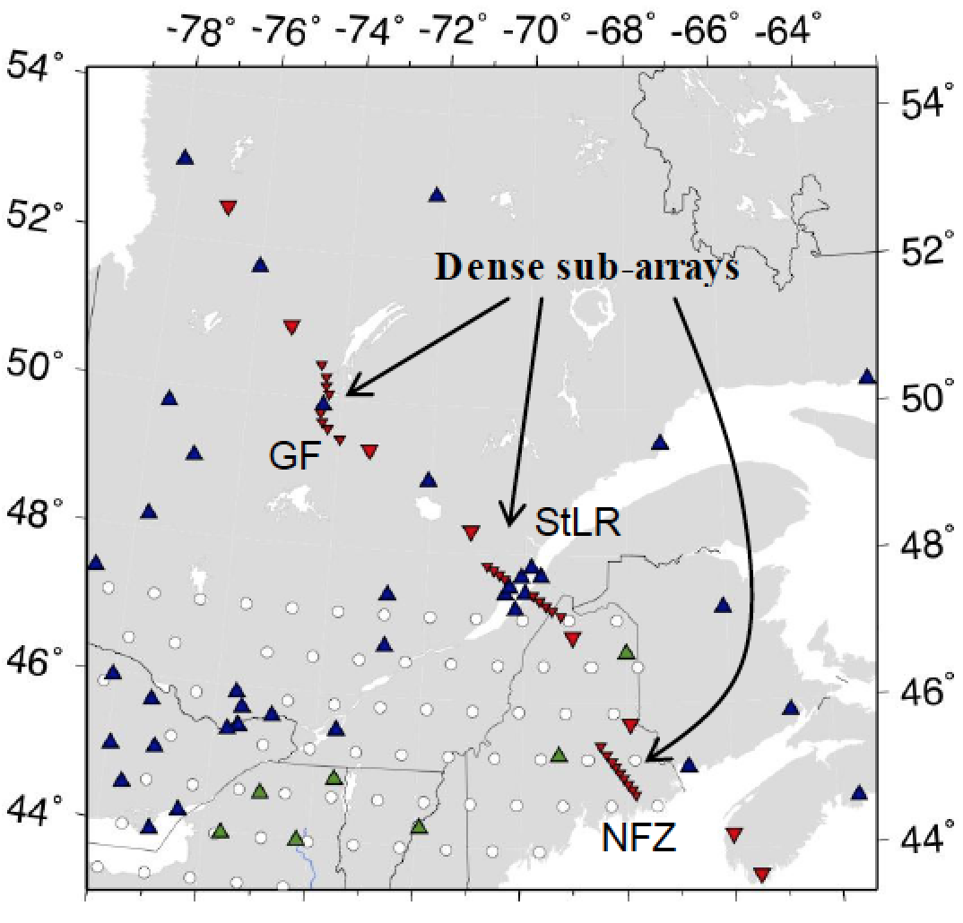
Earthscope's Transportable Array (TA) is a tremendous asset to seismologists studying Earth structure, because it provides extremely high-quality data for the entire land area of the US, a region that includes many important geological features, including plate boundaries, rift zones and hot spots. However, its impact on the "origin of the continents" question is limited, because the core of the continent is not beneath its footprint, but rather lies a little to the north, in Quebec. Our project, timed to take place when the TA is operating in eastern US, is synergistic and provides a companion data set specifically targeted at the cratonic core and surrounding terrain boundaries. We are deploying seismometers in a line stretching from coastal Maine (the edge of the continent) to northern Quebec (its core). The density of stations is variable, and is highest in the three places where terrain boundaries are crossed. We use earth-imaging techniques to test three significant hypotheses: 1) that the bottom of the continental keel is a distinct interface that deepens towards the cratonic core; 2) that the properties of the continent are regionalized (that is, each layer of the onion has its own recognizable properties), with terrain boundaries having a signature that extends right down to the bottom; and 3) that the part of the Earth below the bottom of the continents (the "asthenosphere") is flowing around the keel (in the same sense that ocean water flows around the keel of an iceberg).
The project is supporting two graduate students, providing them with a venue to develop their professional skills as both researcher and teachers. Seismometer operations and data analysis involves undergraduate research assistants, in both summer internship and academic-semester employment modes. During the summer, educational features are incorporated into the fieldtrips to better introduce these undergraduates to the science underpinning the project and more generally to prepare them for a career in science. These include daily science discussions, stops to view important geological features and visits with scientists from collaborating institutions.
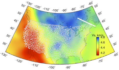
Tomographic map showing location of Quebec-Maine transect relative to the rest of USArray
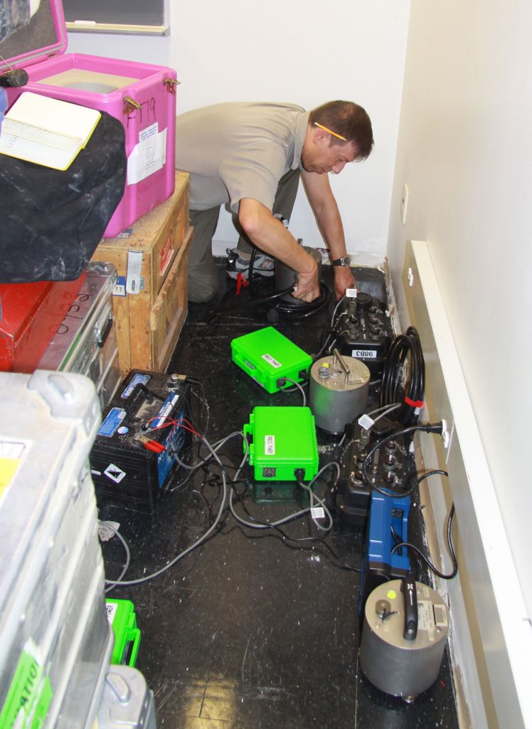
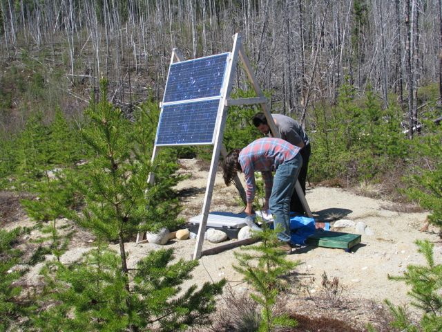
Unloading and testing seismic equipment
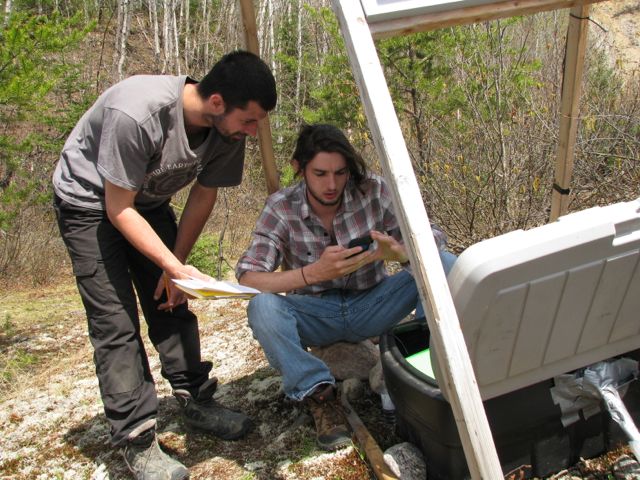
Programming the DAS during station installation/servicing
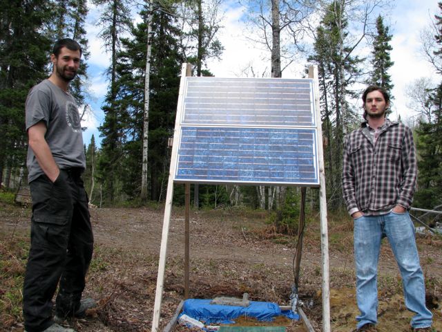
A completed station install
Repairing a damaged station
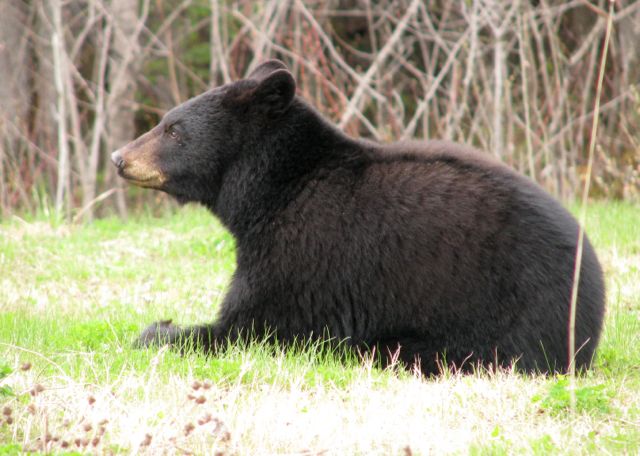
Local wildlife
Publications/Abstracts:
Levin et al., As sharp as you can measure: constraint on the vertical extent of the crust-mantle boundary beneath North American craton (Superior Province, Quebec), presented at 2015 EarthScope national meeting.
Menke et al., Appalachian Front is a Shallow Feature: Insight From Studies of Seismic Wave Speed in the Mantle, presented at 2015 spring AGU meeting.
Servali et al., Detailed study of the Moho boundary in the Superior province of Quebec, presented at 2015 spring AGU meeting.
Dunham et al., Seismic constraints of the crustal structure of the Appalachian Front: An investigation of the St. Lawrence River Valley, presented at 2015 spring AGU meeting.
Klaser et al., Superior Layer-cake: An Investigation of the Mid-Lithospheric Discontinuity in the Superior Craton in Quebec, Canada, presented at 2015 spring AGU meeting.
Levin et al., Superior Layer-Cake: Gradual Lower Boundary and Textured Interior of the Lithosphere, presented at 2015 spring AGU meeting.
Klaser et al., Lithospheric Inventory: An Exploration of Quebec, Canada with P-to-S Receiver Functions, presented at 2014 fall AGU meeting.
Menke et al., EASTERN EDGE OF THE LAURENTIAN CRATONIC LITHOSPHERE BENEATH SOUTHERN QUEBEC FROM TELESEISMIC P WAVES, presented at 2014 fall AGU meeting.

