

J01E
Myrtle Point, OR, USA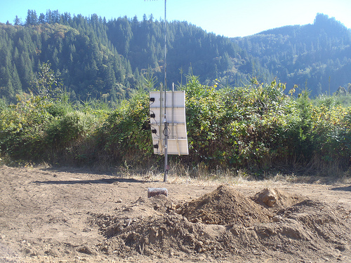
The USArray component of the NSF-funded EarthScope project ended its observational period in September 2021 and all remaining close-out tasks concluded in March 2022. Hundreds of seismic stations were transferred to other operators and continue to collect scientific observations. This USArray.org website is now in an archival state and will no longer be updated. To learn more about this project and the science it continues to enable, please view publications here: http://usarray.org/researchers/pubs and citations of the Transportable Array network DOI 10.7914/SN/TA.
To further advance geophysics support for the geophysics community, UNAVCO and IRIS are merging. The merged organization will be called EarthScope Consortium. As our science becomes more convergent, there is benefit to examining how we can support research and education as a single organization to conduct and advance cutting-edge geophysics. See our Joining Forces website for more information. The site earthscope.org will soon host the new EarthScope Consortium website.

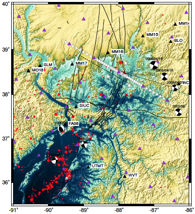 Wabash Valley Seismic Experiment
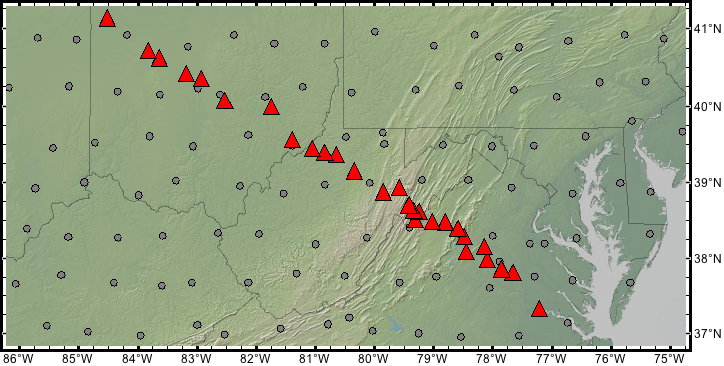 Mid-Atlantic Geophysical Integrative Collaboration (MAGIC)
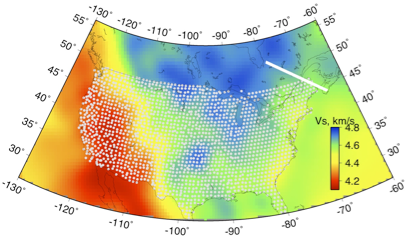 Quebec-Maine Transect
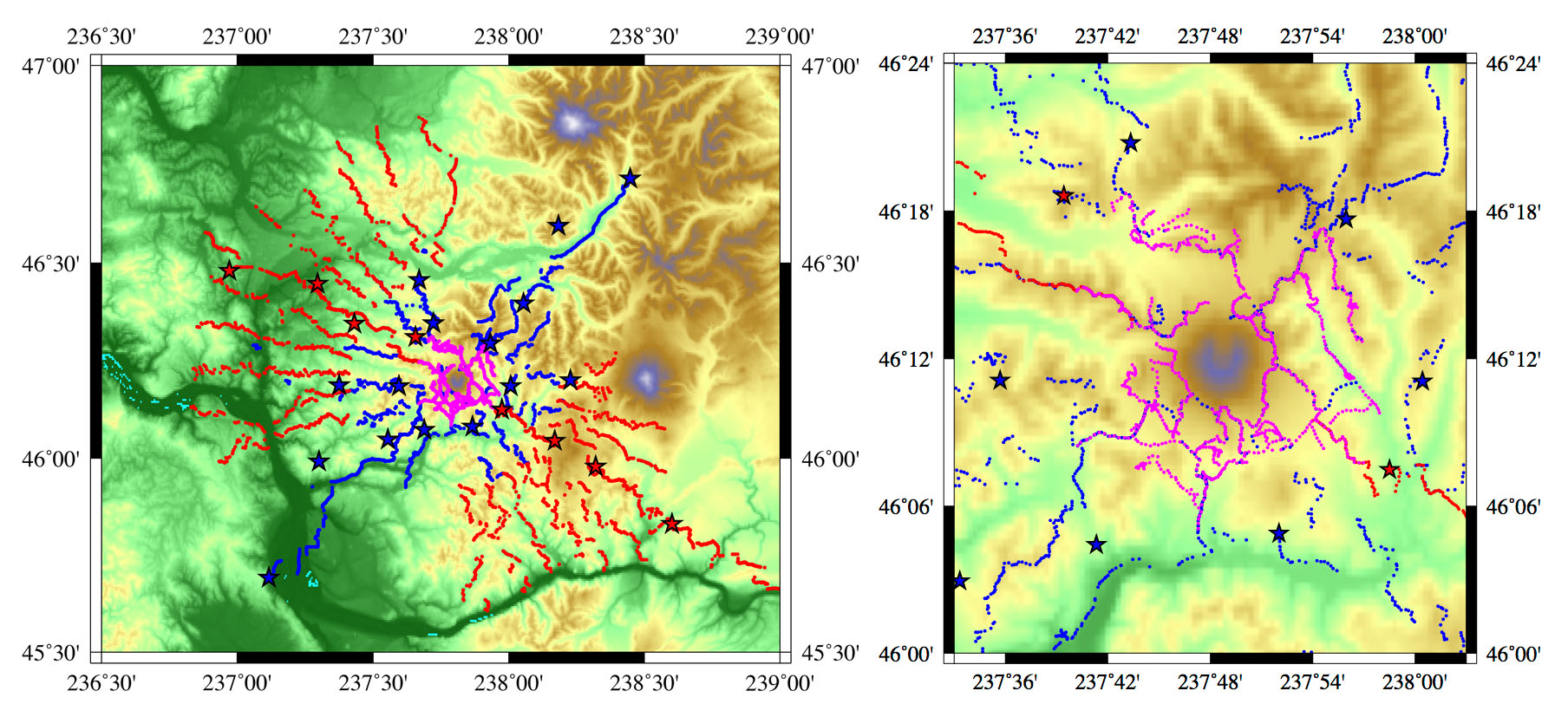 Imaging Magma Under St. Helens (iMUSH)
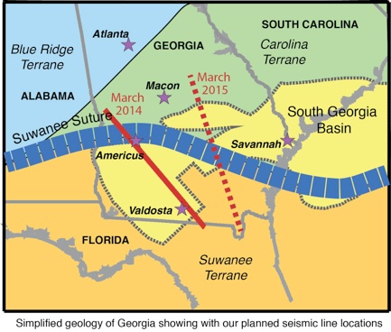 SUwanee Suture and GA Rift basin experiment (SUGAR)
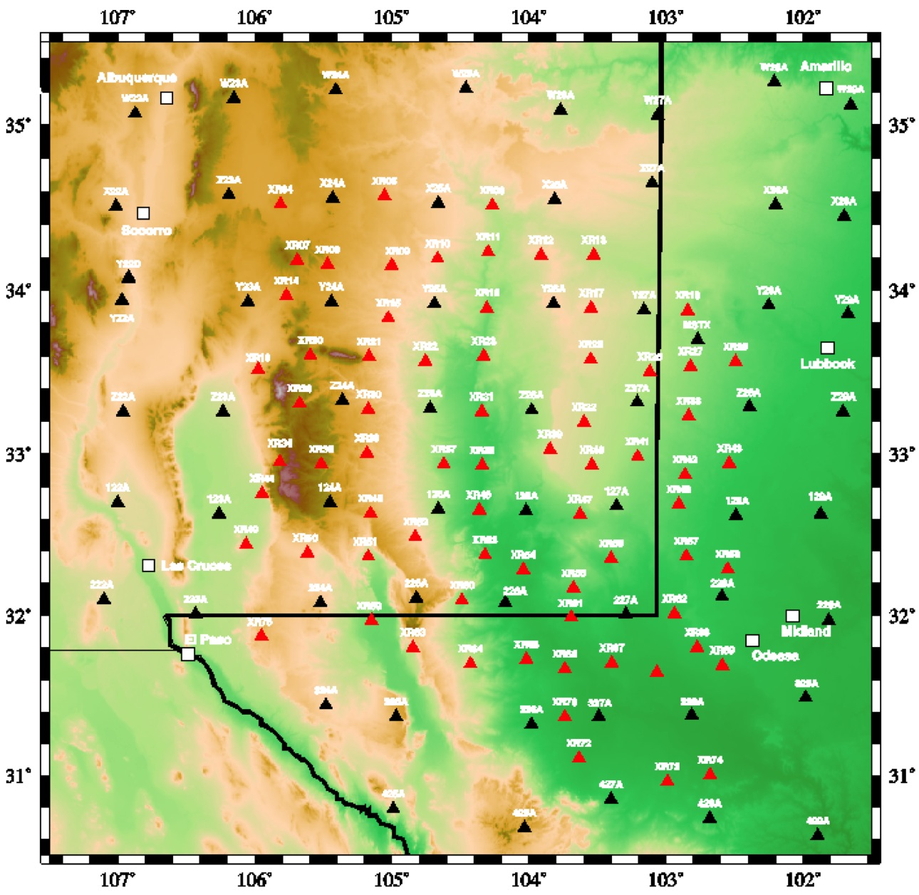 Seismic Investigation of Edge-Driven Convection Associated with the Rio Grande Rift: (SIEDCAR)
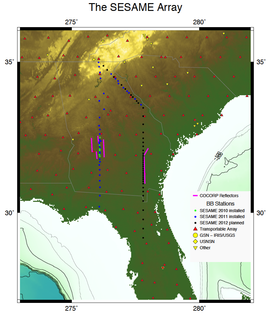 The Southeastern Suture of the Appalachian Margin Experiment: (SESAME)
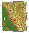 Sierra Nevada EarthScope Project (SNEP)
 Parkfield Trapped Waves
 Basin & Range
 Origin of the Columbia River Basalts and Uplift of the Wallowa Mountains
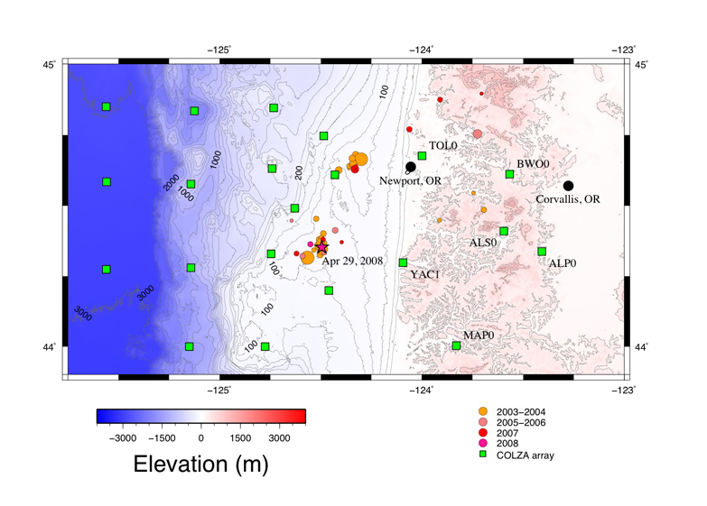 Central Oregon Locked Zone Array: (COLZA)
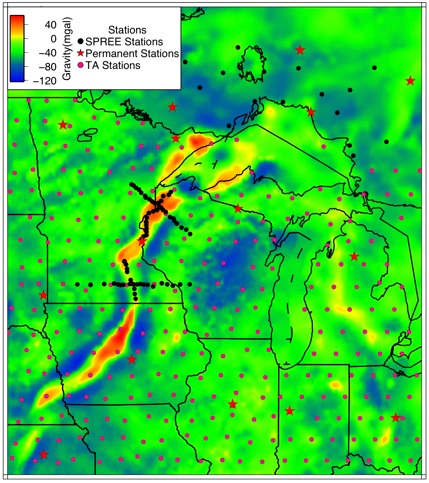 Superior Province Rifting Earthscope Experiment: (SPREE)
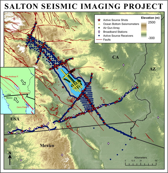 Salton Seismic Imaging Project (SSIP)
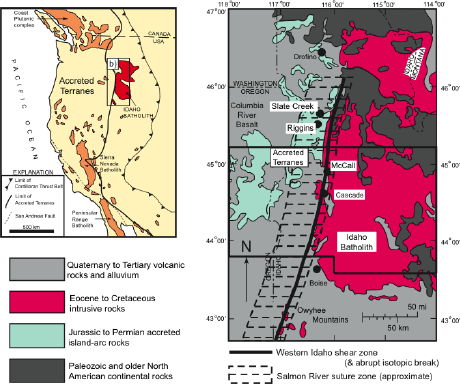 West Idaho Shear: Passive and Active Studies
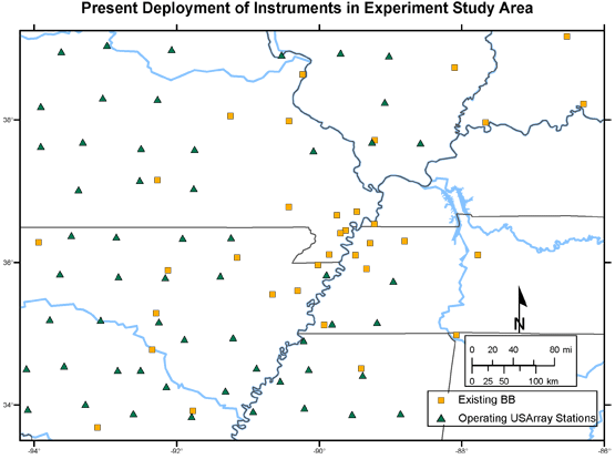 Northern Embayment Lithosphere Experiment: (NELE)
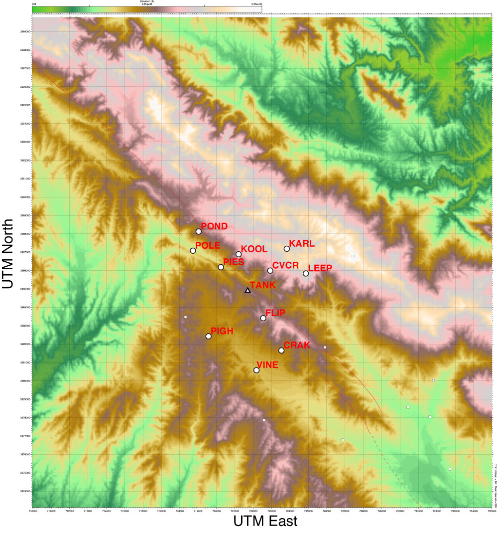 Seismic Tomography and Location Calibration Around the SAFOD Site: (PASO-TRES)
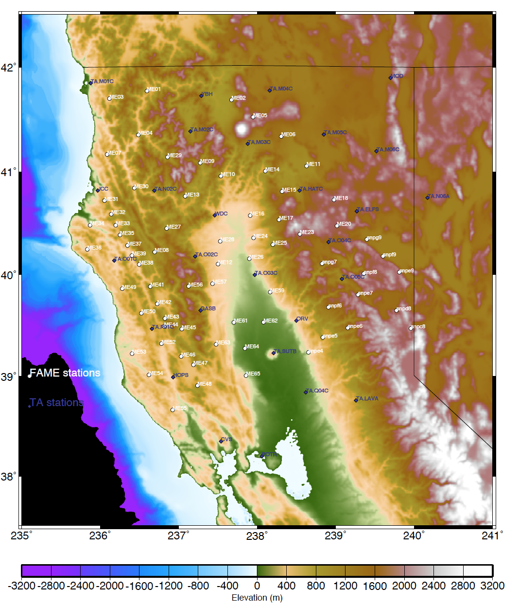 Making the San Andreas Fault at the Mendocino Triple Junction
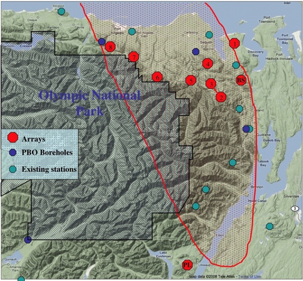 Unlocking the Inner Life of Cascadia Tremor with an Array of Arrays
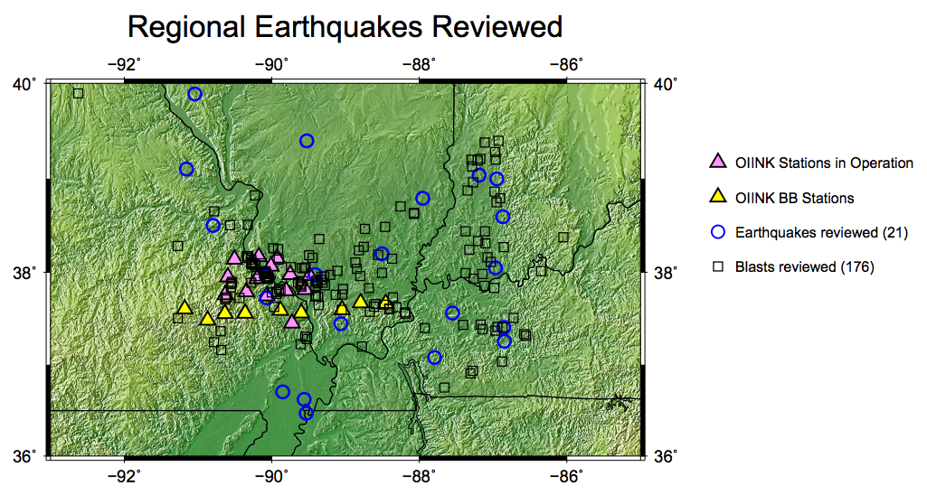 Structure and Dynamics of the North American Craton - An EarthScope Swath from the Ozarks to the Grenville Front: (OIINK)
